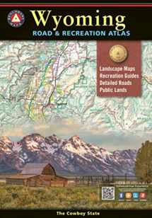
Wyoming Road & Recreation Atlas - 5th Edition, 2022 (Benchmark Road & Recreation Atlases)
Book details
Summary
Description
Product Description
Updated Landscape Maps™
Landscape Maps now include GMU boundaries
National Forest private in-holdings are shown
Over 2,000 miles recently field-checked, resulting in hundreds of edits to recreation points of interest and campgrounds
Recreation Guide
Public Lands maps are completely updated with point-to-point mileages and attractions.
Recreation Guide fact-checked and updated
Parks, Monuments, Natural Wonders
Campgrounds and RV Parks
Boating and Fishing Access
Forest and Wildlife Areas
Experience the wild spirit of Wyoming with Benchmark's Wyoming Road and Recreation Atlas. No other map product can better portray Wyoming's rugged, sky-scraping peaks, or the vast openness where the deer and the antelope really do play! Benchmark's field-checked Landscape Maps clearly depict the terrain, and pinpoint the many backroads that crisscross the state. The Recreation Guides include public land maps and categorize listings of outdoor recreation opportunities, making the most of your next visit to The Cowboy State. Dimensions: 16 inches by 11 inches. 96 pages. Map Scales: Landscape 1:250,000 Recreation 1:750,000
About the Author
In 1995, three respected mapping firms collaborated on a vision they shared for a new line of state road atlases. The result was Benchmark Maps: a partnership that would apply the unique talents of each company to produce atlases with an entirely new kind of look and presentation. These new atlases would combine strikingly beautiful Landscape MapsTM with data collection of unequaled accuracy and detail. Since our beginning, well over a million Benchmark maps and atlases have been purchased by discriminating map users from all over the world. It s not unusual for us to hear from people who have purchased a copy of every one of our atlases.


We would LOVE it if you could help us and other readers by reviewing the book

