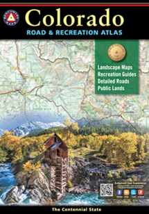
Colorado Road & Recreation Atlas (Benchmark Recreation Atlases)
Book details
Summary
Description
-Over 2,300 miles newly field-checked, reaching 29 Counties and all national parks & forests, resulting in 400+ edits to recreation & camping POI.
-Landscape Maps now include GMU boundaries
-National Forest private in-holdings are shown
Recreation Guide
-Public Lands maps are completely updated with point-to-point mileages and attractions.
-Recreation Guide fact-checked & updated
Benchmark s Colorado Road & Recreation Atlas is designed to help residents and visitors make the most of Colorado s endless recreation opportunities. The recreation guide includes lists of attractions, trailheads, fishing spots, historic sites, and much more throughout the state. The Landscape Maps show all drivable roads, classed by surface and purpose. Large-scale metro maps of Denver, Boulder, and Colorado Springs are also included.
Dimensions: 16 inches x 11 inches. 144 pages
Map Scales: Landscape 1:200,000
Recreation 1:500,000


We would LOVE it if you could help us and other readers by reviewing the book

