Laminated Aruba Map by Borch (English, Spanish, French, Italian and German Edition)
Book details
Summary
Description
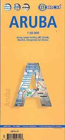
Folded laminated road and travel map, in color. Scale 1:50,000. Distinguishes roads ranging from expressways/motorways to country lanes/paths. Legend includes sights, museums, monuments, churches, chapels, synagogues, archaeological sites, windmills, beaches, shipwrecks, yachting, windsurfing sites, snorkelling, scuba diving sites, hospitals, golf courses, bus stations, parking, petrol stations, international airports, national parks, nature reserves, viewpoints, hotels, markets, prohibited areas. Includes inset map of Lesser Antilles (1:7,000,000), ABC Islands (1:1,000,000), Beaches (1:25,000), Oranjestad (1:10,000), San Nicolas (1:20,000). Climate charts show the average daily temperatures, humidity, hours of sunshine and precipitation for each month. Extensive index.


We would LOVE it if you could help us and other readers by reviewing the book

