Cornells' Ocean Atlas
Book details
Summary
Description
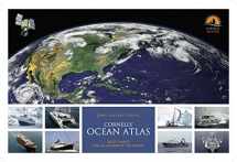
The first edition, published in 2012, was based on satellite observations undertaken in the previous 20 years (1991-2011). The second edition is fully revised and updated by incorporating data gathered during the last five years (2011-2016). So the data now spans 25 years and also reflects any changes that have occurred during this latest period. Besides that, the new edition will also be reformatted to incorporate a new feature: monthly windgrams for the most sailed ocean routes. Windgrams are a summary of wind direction amd strength derived from the individual windroses along a specific ocean route. Cornell's Ocean Atlas is: The first significant innovation in pilot charts - an essential tool for passage planning - since pilot charts were developed by Lieutenant Maury of the US Navy in the mid-1800s. The first and only pilot charts to be based on extensive near real-time geospatial and remote buoy sensing data from 1987 to the present measuring true surface wind and current - gathered from a network of OSCAR and other meteorological satellites, using NOAA and Earth and Space Research (ESR) data programs An integral part of Jimmy Cornell's World Cruising Series - works hand-in-hand with World Voyage Planner, World Cruising Routes and World Cruising Destinations 60 monthly up-to-date pilot charts of all oceans of the world show: current rates and direction wind speed and direction approximate extent of the Intertropical Convergence Zone, commonly known as thedoldrums the most common tracks of tropical storms and the mean location of high pressure cells for each hemisphere


We would LOVE it if you could help us and other readers by reviewing the book

