San Juan and Gulf Islands Nautical and Recreational Planning Map
ISBN-13:
9781932310085
ISBN-10:
1932310088
Author:
Don Douglass and Reanne Hemingway Douglass
Publication date:
2008
Publisher:
Fine Edge Productions
Format:
Map
1 pages
FREE US shipping
Book details
ISBN-13:
9781932310085
ISBN-10:
1932310088
Author:
Don Douglass and Reanne Hemingway Douglass
Publication date:
2008
Publisher:
Fine Edge Productions
Format:
Map
1 pages
Summary
San Juan and Gulf Islands Nautical and Recreational Planning Map (ISBN-13: 9781932310085 and ISBN-10: 1932310088), written by authors
Don Douglass and Reanne Hemingway Douglass, was published by Fine Edge Productions in 2008.
With an overall rating of 3.9 stars, it's a notable title among other
books. You can easily purchase or rent San Juan and Gulf Islands Nautical and Recreational Planning Map (Map) from BooksRun,
along with many other new and used
books
and textbooks.
And, if you're looking to sell your copy, our current buyback offer is $0.3.
Description
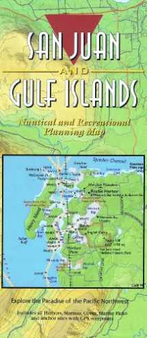
Boating and exploring one of the most popular cruising areas in the world is now easy with this colorful planning map of the San Juan and Gulf Islands. The map covers Deception Pass west to Victoria, and north from Bellingham to Nanaimo. All harbors, coves, anchorages, and Cascade Marine Trail sites for kayaks or canoes are noted, as well as public and Provincial parks. Fine Edge s Proven Cruising Routes© are shown with the Latitude/Longitude GPS waypoints listed for all key locations and the turning points for the routes. The map, by Don Douglass & Réanne Hemingway-Douglass, is a perfect compliment to their best selling Exploring the San Juan & Gulf Islands cruising guide to plan your next trip to the islands.The 2 sided map is 36 wide by 24 high and folds to 4 wide by 9 high and is printed on waterproof paper for convenient use on a boat or carrying in a backpack. The back of the map includes the Canadian Gulf Islands and the GPS Waypoints for the routes shown and all major harbors and coves on the map. The rolled and laminated version of this map makes a great wall display for hanging in the den or office. It is perfect for referencing the location of your favorite locations for a future or past trip. On the boat, it can be used as a high level overview map of the San Juan and Gulf Islands for trip planning with a dry marker.


We would LOVE it if you could help us and other readers by reviewing the book

{user}
{createdAt}
{truncated_title}
{author_block}
by {truncated_author}
