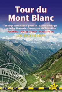
Tour du Mont Blanc: Includes 50 Large-Scale Walking Maps & Guides to 12 Towns and Villages - Planning, Places to Stay, Places to Eat (Trailblazer)
ISBN-13:
9781905864928
ISBN-10:
1905864922
Edition:
Second
Author:
Jim Manthorpe
Publication date:
2019
Publisher:
Trailblazer Publications
Format:
Paperback
204 pages
Category:
Mountaineering & Climbing
,
Outdoor Recreation
FREE US shipping
on ALL non-marketplace orders
Rent
35 days
Due Aug 07, 2024
35 days
from $32.16
USD
Marketplace
from $31.78
USD
Marketplace offers
Seller
Condition
Note
Seller
Condition
Used - Good
Book details
ISBN-13:
9781905864928
ISBN-10:
1905864922
Edition:
Second
Author:
Jim Manthorpe
Publication date:
2019
Publisher:
Trailblazer Publications
Format:
Paperback
204 pages
Category:
Mountaineering & Climbing
,
Outdoor Recreation
Summary
Tour du Mont Blanc: Includes 50 Large-Scale Walking Maps & Guides to 12 Towns and Villages - Planning, Places to Stay, Places to Eat (Trailblazer) (ISBN-13: 9781905864928 and ISBN-10: 1905864922), written by authors
Jim Manthorpe, was published by Trailblazer Publications in 2019.
With an overall rating of 3.6 stars, it's a notable title among other
Mountaineering & Climbing
(Outdoor Recreation) books. You can easily purchase or rent Tour du Mont Blanc: Includes 50 Large-Scale Walking Maps & Guides to 12 Towns and Villages - Planning, Places to Stay, Places to Eat (Trailblazer) (Paperback) from BooksRun,
along with many other new and used
Mountaineering & Climbing
books
and textbooks.
And, if you're looking to sell your copy, our current buyback offer is $2.62.
Description
At 15,781ft, Mont Blanc is the highest mountain in western Europe. All-in-one hiking route guide, maps and accommodations for the trail (105 miles, 168km) that circumnavigates the massif. Passing through France, Italy and Switzerland, is the most popular long distance walk in Europe. Includes 50 large-scale walking maps; 12 town maps and 2 overview maps. Full details of all accommodations and campsites, restaurants and inns; plus full public transport information. Includes day-walks.
This guide includes:
Itineraries for all walkers – whether walking the 105 mile (168km) route in its entirety, or sampling the highlights on day walks and short breaks
Practical information for all budgets – where to stay (campsites, gîtes, hostels, B&Bs, lodges and hotels), where to eat, what to see
Comprehensive background information – the Alps, flora and fauna, the history of mountaineering and trekking in the region and the conquest of Mont Blanc in 1786 by Bourrit and Balmat
Town guides to Chamonix, Courmayeur and Argentiere
Full public transport information – for all access pointsClimbing Mont Blanc – practical information, guides, the route to the top


We would LOVE it if you could help us and other readers by reviewing the book
Book review

Congratulations! We have received your book review.
{user}
{createdAt}
by {truncated_author}


