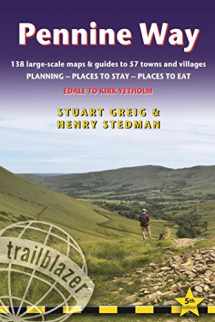
Pennine Way: British Walking Guide: planning, places to stay, places to eat; includes 138 large-scale walking maps (Trailblazer)
ISBN-13:
9781905864614
ISBN-10:
1905864612
Edition:
Fourth
Author:
Chris Scott, Keith Carter, Stuart Greig
Publication date:
2015
Publisher:
Trailblazer Publications
Format:
Paperback
272 pages
FREE US shipping
Book details
ISBN-13:
9781905864614
ISBN-10:
1905864612
Edition:
Fourth
Author:
Chris Scott, Keith Carter, Stuart Greig
Publication date:
2015
Publisher:
Trailblazer Publications
Format:
Paperback
272 pages
Summary
Pennine Way: British Walking Guide: planning, places to stay, places to eat; includes 138 large-scale walking maps (Trailblazer) (ISBN-13: 9781905864614 and ISBN-10: 1905864612), written by authors
Chris Scott, Keith Carter, Stuart Greig, was published by Trailblazer Publications in 2015.
With an overall rating of 3.5 stars, it's a notable title among other
books. You can easily purchase or rent Pennine Way: British Walking Guide: planning, places to stay, places to eat; includes 138 large-scale walking maps (Trailblazer) (Paperback) from BooksRun,
along with many other new and used
books
and textbooks.
And, if you're looking to sell your copy, our current buyback offer is $0.3.
Description
Britain’s best-known National Trail winds for 256 miles through three National Parks – the Peak District, Yorkshire Dales and Northumberland. This superb footpath showcases Britain’s finest upland scenery, while touching the literary landscape of the Bronte family and Roman history along Hadrian’s Wall.
- 138 large-scale walking maps – at just under 1:20,000 – showing route times, gradients, where to stay, interesting features.
- Guides to 57 towns and villages – along the way
- Itineraries for all walkers – whether walking the route in its entirety or sampling the highlights on day walks and short breaks.
- Practical information for all budgets – Edale to Kirk Yetholm: where to stay (B&Bs, hostels, campsites, pubs and hotels), where to eat, what to see, plus detailed town plans
- Public transport information – all access points on the path.
- GPS waypoints. These are also downloadable from the Trailblazer website.
- Now includes extra color sections: 16pp color introduction and 16pp of color mapping for stage sections (one stage per page) with trail profiles.


We would LOVE it if you could help us and other readers by reviewing the book

{user}
{createdAt}
{truncated_title}
{author_block}
by {truncated_author}
