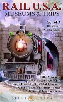
Rail USA Museums & Trips! Maps & Guides to 1200+ Train Rides, Heritage Railroads, Historic Depots, Railroad & Trolley Museums, Model Layouts, Train Watching Hotspots, Historic Sites & More
Book details
Summary
Description
The ultimate guides for rail enthusiasts! More than 1,200 attractions in all 50 states. Three illustrated regional guide maps included: Eastern, Central & Western States. Rail museums, historic depots, scenic railroads, dinner trains, trolleys, model layouts, train-watching locations...and more...are located on detailed maps for easy travel planning. Directory includes descriptions of each venue and GPS-ready addresses and contact info. 48 eye-catching, original watercolor illustrations of historic trains, stations & sites. Each map is 27 x 39 inches, folded to 6 x 9-3/4 inches. Printed two sides. The three maps are shrink-wrapped in a cardstock folder.
Individual titles also offered separately on Amazon. For Eastern States, search 1888216476. Central States, search 1888216492. Western States, search 1888216514.


We would LOVE it if you could help us and other readers by reviewing the book

