John Muir Trail Map-Pack: Shaded Relief Topo Maps (Tom Harrison Maps)
ISBN-13:
9781877689345
ISBN-10:
1877689343
Author:
Tom Harrison
Publication date:
2015
Publisher:
Tom Harrison Maps
Format:
Map
13 pages
FREE US shipping
on ALL non-marketplace orders
Book details
ISBN-13:
9781877689345
ISBN-10:
1877689343
Author:
Tom Harrison
Publication date:
2015
Publisher:
Tom Harrison Maps
Format:
Map
13 pages
Summary
John Muir Trail Map-Pack: Shaded Relief Topo Maps (Tom Harrison Maps) (ISBN-13: 9781877689345 and ISBN-10: 1877689343), written by authors
Tom Harrison, was published by Tom Harrison Maps in 2015.
With an overall rating of 4.0 stars, it's a notable title among other
books. You can easily purchase or rent John Muir Trail Map-Pack: Shaded Relief Topo Maps (Tom Harrison Maps) (Map) from BooksRun,
along with many other new and used
books
and textbooks.
And, if you're looking to sell your copy, our current buyback offer is $5.05.
Description
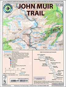
Shaded Relief Topo Maps packet of the famous Sierra High Route that will take hikers from Mount Whitney to Yosemite, CA. Well marked trails over USGS topo maps that were beautifully enhanced with shaded relief to better distinguish details. Scale 1:630360. 1 inch on map equals 1 mile. Whitney Portal, Symmes Creek, Onion Valley, Oak Creek, Taboose Creek, North and South Lakes, Vermilion, Bear Creek, Florence Lake, Pine Creek, Mono Pass, McGee Creek, Devils Postpile, Mammoth Lakes, Agnew Meadows, Silver Lake, Tuolomne Meadows, and finally the Yosemite Valley. GPS Compatible! - Complete UTM Grid.


We would LOVE it if you could help us and other readers by reviewing the book

{user}
{createdAt}
{truncated_title}
{author_block}
by {truncated_author}
