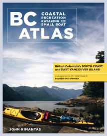
BC Coastal Recreation Kayaking and Small Boat Atla: Vol. 1: British Columbia's South Coast and East Vancouver Island (Kayaking and Small Boat Atlas)
Book details
Summary
Description
Rugged yet serene, the south and east coasts of Vancouver Island are unlike anywhere else. Wave-sculpted rocks, sea caves and fjords, old-growth forests, incredible wildlife, and white, sandy beaches make this an unbeatable destination. From a veteran kayaker and outdoors expert, who has explored the BC coastline himself, comes this must-have collection of full-colour maps, all from a paddler's perspective.
This large-book format is easier to use and stow than bulky charts and unwieldy roll-up maps. Kimantas himself remarks that his life would have been much easier had one of these been available for his own kayak trips! The features and attractions included in these maps are numerous. You'll see all the campsites, rest areas, launch sites, anchorages, private marinas, government wharves, ferry terminals, and lighthouses, as well as the possible hazards of each area. Also included are the key places to see killer whales, grizzlies, sea lions, and birds and to explore heritage sites, ruins, sunken ships, trails, and parks. Colour photographs right on the maps provide visual clues and added beauty.
Volume 1, South BC Coast and East Vancouver Island
This volume provides an overview of British Columbia's south coast from Victoria to Port McNeill, and from Howe Sound to the Broughton Islands.
Volume 2, West Vancouver Island
This volume provides an overview of West Vancouver Island from Sooke to Port Hardy.


We would LOVE it if you could help us and other readers by reviewing the book

