USA State Maps Coloring Book: 50 USA States and Territories, Blank, Outline Maps for Coloring and Education (World of Maps)
ISBN-13:
9781505475234
ISBN-10:
1505475236
Edition:
Clr
Author:
J. Bruce Jones
Publication date:
2014
Publisher:
CreateSpace Independent Publishing Platform
Format:
Paperback
130 pages
FREE US shipping
Book details
ISBN-13:
9781505475234
ISBN-10:
1505475236
Edition:
Clr
Author:
J. Bruce Jones
Publication date:
2014
Publisher:
CreateSpace Independent Publishing Platform
Format:
Paperback
130 pages
Summary
USA State Maps Coloring Book: 50 USA States and Territories, Blank, Outline Maps for Coloring and Education (World of Maps) (ISBN-13: 9781505475234 and ISBN-10: 1505475236), written by authors
J. Bruce Jones, was published by CreateSpace Independent Publishing Platform in 2014.
With an overall rating of 3.7 stars, it's a notable title among other
books. You can easily purchase or rent USA State Maps Coloring Book: 50 USA States and Territories, Blank, Outline Maps for Coloring and Education (World of Maps) (Paperback) from BooksRun,
along with many other new and used
books
and textbooks.
And, if you're looking to sell your copy, our current buyback offer is $0.09.
Description
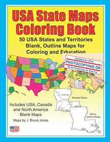
Color the 50 USA States and Territories in the USA State Maps Coloring Book: 50 USA States and Territories, Blank, Outline Maps for Coloring and Education. USA State Maps Coloring Book is great for coloring, home school, education and learning geography. Each outline map is presented in two ways, the left page has the map with its corresponding cities, capitals and physical features. The opposite right page has a blank outline of the state without any of information. The detail page also includes a US map with the state located on it. Students can trace the outlines of each map, study and highlight cities, capitals and features. The opposite page is a blank outline map of the same state, great for reviewing and coloring. Students can fill it in however they want. Great book for teaching students, They can add the political, physical and regional information on each state. Over 110 maps.USA State Maps Coloring Book IncludesIncludes maps of all 50 US States: Alabama, Alaska, Arizona, Arkansas, California, Colorado, Connecticut, Delaware, Florida, Georgia, Hawaii, Idaho and Illinois. Also Includes maps of: Indiana, Iowa, Kansas, Kentucky, Louisiana, Maine, Maryland, Massachusetts, Michigan, Minnesota, Mississippi, Missouri, Montana, Nebraska, Nevada and New Hampshire. And outline state maps of: New Jersey, New Mexico, New York, North Carolina, North Dakota, Ohio, Oklahoma, Oregon, Pennsylvania, Rhode Island, South Carolina, South Dakota, Tennessee, Texas, Utah, Vermont, Virginia, Washington, West Virginia, Wisconsin and Wyoming. Also included are maps of the US territories: Guam, Saipan, Northern Mariana Islands, Puerto Rico, and the United States Virgin Islands. Along with two North America maps, Canada, and two World projection maps.Please note: the printable, blank, outline maps in our coloring book can be freely photocopied by a teacher or parent for use in a classroom or for home school lessons.


We would LOVE it if you could help us and other readers by reviewing the book

{user}
{createdAt}
{truncated_title}
{author_block}
by {truncated_author}
