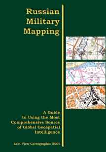
Russian Military Mapping: A Guide to Using the Most Comprehensive Source of Global Geospatial Intelligence
ISBN-13:
9780974297316
ISBN-10:
0974297313
Edition:
Laminated
Author:
A.A. Psarev, Valery N. Filatov
Publication date:
2005
Publisher:
East View Cartographic
Format:
Hardcover
188 pages
Category:
Atlases & Maps
,
Cartography
,
Earth Sciences
FREE US shipping
Book details
ISBN-13:
9780974297316
ISBN-10:
0974297313
Edition:
Laminated
Author:
A.A. Psarev, Valery N. Filatov
Publication date:
2005
Publisher:
East View Cartographic
Format:
Hardcover
188 pages
Category:
Atlases & Maps
,
Cartography
,
Earth Sciences
Summary
Russian Military Mapping: A Guide to Using the Most Comprehensive Source of Global Geospatial Intelligence (ISBN-13: 9780974297316 and ISBN-10: 0974297313), written by authors
A.A. Psarev, Valery N. Filatov, was published by East View Cartographic in 2005.
With an overall rating of 3.6 stars, it's a notable title among other
Atlases & Maps
(Cartography, Earth Sciences) books. You can easily purchase or rent Russian Military Mapping: A Guide to Using the Most Comprehensive Source of Global Geospatial Intelligence (Hardcover) from BooksRun,
along with many other new and used
Atlases & Maps
books
and textbooks.
And, if you're looking to sell your copy, our current buyback offer is $0.3.
Description
A comprehensive overview of Russian military topographic maps and related publications. Russian Military Mapping is the English-language translation of the current edition of a basic manual used in the Russian armed forces to introduce Russian officers to topographic and other special maps. This book is a major contribution to the literature of understanding and interpreting Russian (or Soviet) topographic maps. This manual contains material systematized into the following major sections: general information on the Earth's atmosphere, weather and climate, winds, and concepts of time; basic data on topographic and special maps; description of terrain types and their tactical properties, and procedures for maintaining the commander's working maps. The appendices contain several types of reference data, sample topographic and special maps, tables of symbols used for topographic maps, and some conventional designations and abbreviation used in combat documents.


We would LOVE it if you could help us and other readers by reviewing the book
Book review

Congratulations! We have received your book review.
{user}
{createdAt}
by {truncated_author}


