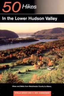
9780881505573-0881505579-50 Hikes in the Lower Hudson Valley: Hikes and Walks from Westchester County to Albany (50 Hikes Series)

50 Hikes in the Lower Hudson Valley: Hikes and Walks from Westchester County to Albany (50 Hikes Series)

ISBN-13: 9780881505573
ISBN-10: 0881505579
Author: Stella J. Green, H. Neil Zimmerman
Publication date: 2002
Publisher: Countryman Pr
Format: Paperback 288 pages
FREE US shipping

Book details

ISBN-13: 9780881505573
ISBN-10: 0881505579
Author: Stella J. Green, H. Neil Zimmerman
Publication date: 2002
Publisher: Countryman Pr
Format: Paperback 288 pages

Summary

50 Hikes in the Lower Hudson Valley: Hikes and Walks from Westchester County to Albany (50 Hikes Series) (ISBN-13: 9780881505573 and ISBN-10: 0881505579), written by authors Stella J. Green, H. Neil Zimmerman, was published by Countryman Pr in 2002. With an overall rating of 4.0 stars, it's a notable title among other Hiking & Camping (Outdoor Recreation) books. You can easily purchase or rent 50 Hikes in the Lower Hudson Valley: Hikes and Walks from Westchester County to Albany (50 Hikes Series) (Paperback) from BooksRun, along with many other new and used Hiking & Camping books and textbooks. And, if you're looking to sell your copy, our current buyback offer is $0.3.

Description

A brand-new hiking guide to the scenic Hudson Valley region south of Albany. This all-new guide to hiking the Hudson River Valley reveals 50 walks and hikes from the East Hudson Highlands, to Rockland County and Harriman Park, to the West Hudson Hills, to the Shawangunks, and more. Green and Zimmerman are expert guides to this region rich in history and culture. Hikers will discover some of the most spectacular viewpoints in the region, places that inspired the Hudson River school of painting and that still convey a unique sense of wildness. Most of the hikes in this guide are within a two-hour drive of New York City; an at-a-glance overview chart makes it easy to choose a trip for hikers of all abilities. Each hike description includes a topographical map, driving directions, mileage and rise, and a detailed trail description. 40 black and white photographs, 51 maps, index.

Rate this book Rate this book

We would LOVE it if you could help us and other readers by reviewing the book