Rand McNally 2024 Large Scale Road Atlas - 100th Anniversary Collector's Edition (The Rand McNally Large Scale Road Atlas)
Book details
Summary
Description
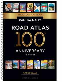
Beginning with it's predecessor, the Auto Chum in 1924, the Rand McNally Road Atlas has been the essential, trusted tool for road travelers for 100 years. Celebrating its centennial anniversary, this 2024 Special Collector's Edition features a custom cover showcasing Road Atlas covers throughout the years. This spiral-bound Large Scale edition featuring all the accuracy you've come to expect from Rand McNally, only bigger. This updated 2024 edition contains maps of every U.S. state, plus expanded coverage of Canada and Mexico, that are 35% larger than the standard atlas version. Includes over 350 detailed city inset and national park maps and a comprehensive, unabridged index. Road construction and conditions contact information for every state are conveniently located on map pages. Contains mileage chart showing distances between 77 North American cities and national parks with driving times map. Tough spiral binding allows the book to lay open easily. Other Features: A convenient page locator map on the inside cover makes it quick and easy to find the map you need. Tell Rand! As much as we work to keep our atlases up to date, conditions change quickly and new construction projects begin frequently. If you know of something we haven't captured in our atlas, let us know at randmcnally.com/tellrand. Tourism websites and phone numbers for every U.S. state and Canadian province on map page. Dimensions: 10 3/8 x 15 3/8. Spiral Binding.


We would LOVE it if you could help us and other readers by reviewing the book

