Rand McNally 2024 Road Atlas: United States, Canada, Mexico: 100th Anniversary (Rand McNally Road Atlas: United States, Canada, Mexico)
Book details
Summary
Description
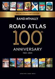
Beginning with it's predecessor, the Auto Chum in 1924, the Rand McNally Road Atlas has been the essential, trusted tool for road travelers for 100 years. Celebrating its centennial anniversary, this 2024 Special Collector's Edition features a trip down memory lane - a nostalgic look back at 100 years of roadside culture, cars, and the highway system that shaped the open road, as well as showcasing Road Atlas covers throughout the years. This updated 2024 edition contains maps of every U.S. state and Canadian province, an overview map of Mexico, and detailed inset maps of over 350 cities and 20 national parks. Road construction and conditions contact information for every state conveniently located above the maps. Contains mileage chart showing distances between 90 North American cities and national parks along with a driving times map. Tell Rand! As much as we work to keep our atlases up to date, conditions change quickly and new construction projects begin frequently. If you know of something we haven't captured in our atlas, let us know at randmcnally.com/tellrand. Tourism websites and phone numbers for every U.S. state and Canadian province on map pages. Dimensions: 10 7/8 x 15 3/8.


We would LOVE it if you could help us and other readers by reviewing the book

