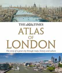
The Times Atlas of London: The Story of a Great City Through Maps, History and Culture (The Times Atlases)
ISBN-13:
9780007434220
ISBN-10:
0007434227
Edition:
Slp
Author:
The Times UK
Publication date:
2011
Publisher:
HarperCollins UK
Format:
Hardcover
304 pages
FREE US shipping
Book details
ISBN-13:
9780007434220
ISBN-10:
0007434227
Edition:
Slp
Author:
The Times UK
Publication date:
2011
Publisher:
HarperCollins UK
Format:
Hardcover
304 pages
Summary
The Times Atlas of London: The Story of a Great City Through Maps, History and Culture (The Times Atlases) (ISBN-13: 9780007434220 and ISBN-10: 0007434227), written by authors
The Times UK, was published by HarperCollins UK in 2011.
With an overall rating of 4.3 stars, it's a notable title among other
books. You can easily purchase or rent The Times Atlas of London: The Story of a Great City Through Maps, History and Culture (The Times Atlases) (Hardcover) from BooksRun,
along with many other new and used
books
and textbooks.
And, if you're looking to sell your copy, our current buyback offer is $0.53.
Description
Authoritative and prestigious atlas with detailed mapping and photographs for the whole of Greater London. Fully up-to-date reference maps, statistics, images, and historical mapping give an exceptionally detailed view of London helping you explore this great city. Contents include; The mapping of London 12 pages covering the history of mapping London with extracts from maps from the 16th century to the present day. London in context Regional map of the southeast Physical map with rivers and parks of London Geology Climate Comparisons with other British and international Defining London The Greater London area Parliamentary constituencies map, London Assembly constituency map. Chronology of London London Today Sections on each London borough, listed alphabetically. For each borough there is to be a locator map and selected street mapping, either to show changes (using street mapping 1908, 1941 and 2010) or just to provide greater detail—for example the City, Westminster and Kensington and Chelsea as well as the southern parts of Camden and Islington The sections on the boroughs are to be interspersed with thematic spreads covering London-wide topics.


We would LOVE it if you could help us and other readers by reviewing the book
Book review

Congratulations! We have received your book review.
{user}
{createdAt}
by {truncated_author}


