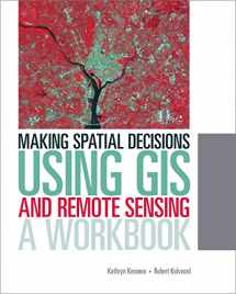
9781589483361-1589483367-Making Spatial Decisions Using GIS and Remote Sensing: A Workbook (Making Spatial Decisions, 2)

Making Spatial Decisions Using GIS and Remote Sensing: A Workbook (Making Spatial Decisions, 2)

ISBN-13: 9781589483361
ISBN-10: 1589483367
Edition: 1
Author: Kathryn Keranen, Robert Kolvoord
Publication date: 2013
Publisher: Esri Press
Format: Paperback 300 pages
FREE US shipping

Book details

ISBN-13: 9781589483361
ISBN-10: 1589483367
Edition: 1
Author: Kathryn Keranen, Robert Kolvoord
Publication date: 2013
Publisher: Esri Press
Format: Paperback 300 pages

Summary

Making Spatial Decisions Using GIS and Remote Sensing: A Workbook (Making Spatial Decisions, 2) (ISBN-13: 9781589483361 and ISBN-10: 1589483367), written by authors Kathryn Keranen, Robert Kolvoord, was published by Esri Press in 2013. With an overall rating of 3.6 stars, it's a notable title among other Computer Modelling (Engineering) books. You can easily purchase or rent Making Spatial Decisions Using GIS and Remote Sensing: A Workbook (Making Spatial Decisions, 2) (Paperback) from BooksRun, along with many other new and used Computer Modelling books and textbooks. And, if you're looking to sell your copy, our current buyback offer is $0.6.

Description

Making Spatial Decisions Using GIS and Remote Sensing is the first workbook to highlight the image processing capabilities inherent in ArcGIS software. Designed to complement remote sensing textbooks in an undergraduate curriculum, this workbook teaches students image processing and analysis skills with ArcGIS 10.1 for Desktop. The book uses step-by-step instruction, guided activities that reinforce learned concepts, and independent projects that encourage students to solve problems using local data.

A DVD with Landsat imagery and other data accompanies the book along with access to ArcGIS 10.1 for Desktop Advanced software (180-day use)

Rate this book Rate this book

We would LOVE it if you could help us and other readers by reviewing the book